History
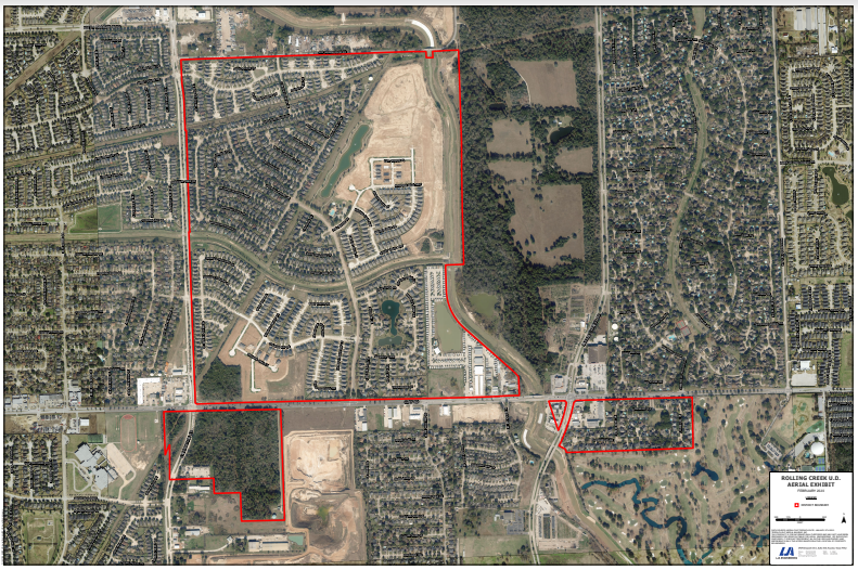
Rolling Creek Utility District, a political subdivision of the State of Texas, was created by an Act of the 62nd Legislature of the State of Texas, Regular Session, 1971. The District contains approximately 552.14 acres of land. The District is located entirely within the extraterritorial jurisdiction of the City of Houston, Texas, approximately 21 miles northwest of the central business district of Houston. The largest portion of the District is bounded on the north by Old Greenhouse Road, on the west by Greenhouse Road, on the east by Bear Creek and on the south by Clay Road. The District also contains tracts at the southeast corner of Greenhouse Road and Clay Road and at the southeast and southwest corners of Barker-Cypress Road and Clay Road. The District is located entirely within Harris County, Texas. The District serves the Rolling Creek, Grand Oaks, and Amesbury Park Subdivisions.
District Map